General Discussion
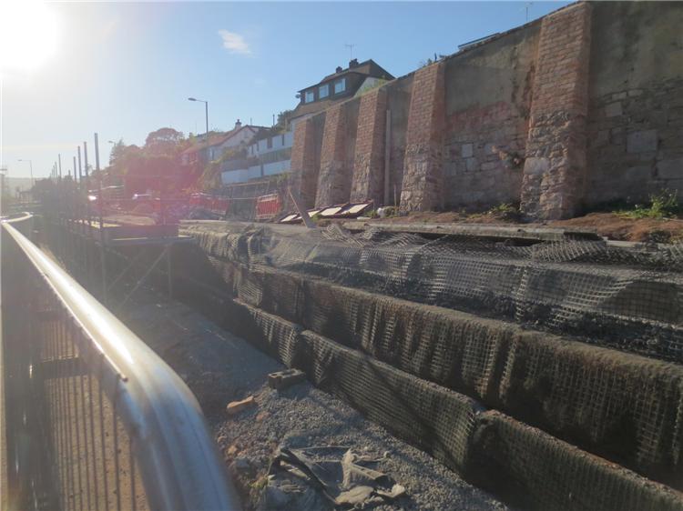
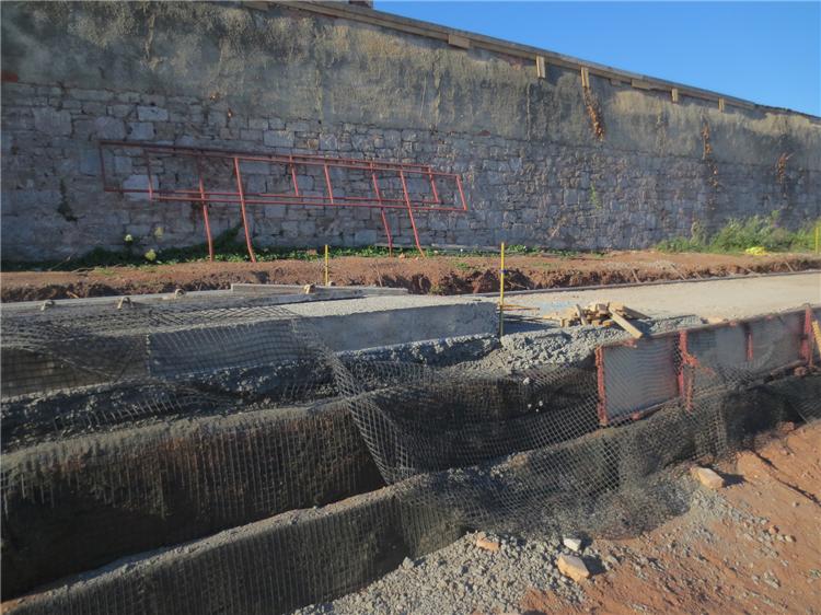
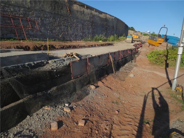
I may have the wrong end of the stick, but why has work already started on this application when it is yet to be approved.
From looking at the application for the changes to Lanherne to accomodate the new cycle path. It states on the application that the target date for a decision on whether the plan is approved is the 01/09/16 and the public expiry date is the 02/09/16 which in itself is rather strange.
The application was received on the 10/08/16, but work on construction of the new cycle path has been going on for many weeks in relations to the specifics of this request.
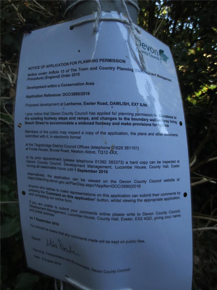
The DCC 'notice of application for planning permission' ref letter on the site does tally with the application ref above. (pic below of letter).
Below is the link to the application on the planning website:-
Can anyone shine some light on the specifics of why the work being is being carried out in relation to this application when approval has not been given yet, let alone the public's right to comment on it ?
The only other planning application I can see for this area specific to DCC and Lanherne is this one:-
and the doc's are currently unavailabel, but the specifics are -
A) Partial reduction in height to Lanherne wall adjacent to the A379.
B) Installation of trief kerbs along said section.
This application was passed on the 04/04/16.


This is a Devon County Council planning application for the reconfiguration of the footpath down from Lanherne to Beach Street. The work will entail removal of trees, the instalation of a new zig-zag path with shallow steps (and a bike wheel gulley) and the widening of the entrance into Beach Street. This is the latest section of the 'Destination Dawlish' cycle path, the continuation of which has recently been the subject of public consultation.

@Gary Taylor - thankyou for the reply, can you advise me of the planning req no for the work shown in my photographs so that i can check the details, it would be appreciated.

@Gary Taylor - thanks for the reply, but this was the only other planning req that i was able to find and it does not include the work currently being carried out as shown in the pics i have included. i can only assume that the work to the cycle path in the pics is related to the planning app 16/02234/dcr and they decided to go ahead long before the planning app was even submitted.

Below is the PRoW statement from this planning application, BEE9:
National Cycle Network Route 2 (NCN2). Dawlish-Lanherne Open Space and PROW statement. The proposal is for a shared used path wholly off road through Lanherne, Dawlish, and form part of National Cycle Network Route 2 (NCN2). Present land use is urban amenity green space, some of which is landscaped with shrubs, some of which is overgrown allotment, and some lawn. NCN2 is a long distance cycle route that will eventually link St Austell with Dover along the south coast of England. There is no existing public right of way over the land to be occupied by the proposal. The access road is dedicated as “highway” The path once completed will promoting health and well-being - providing opportunities to people of all ages for informal recreation, or to walk, cycle or ride within the existing green space. The proposal affords public access to enjoy this open space, whilst being a positive element in the landscape, and providing a safer route, off road for all users.
The Design and Access Statement (which runs to 5 pages and includes details of the cycle path works) can also be found under the 'Supporting Reports and Documents' section of DCC/3831/2016. Hope this helps.


